


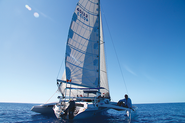
The awesome adventures of the Linda O (published July 2012)
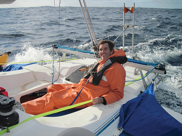
The lunchtime office escapee had been enjoying a beautiful fall day at the Wahoo Cut Public Boat Ramp in Charleston, SC when he came upon two unlikely characters launching a very different looking boat. “So, you’re going to the Turks and Caicos Islands, huh?” asked the man disbelievingly as he inspected the Linda O., our 2001 Corsair F-28 trimaran. Weighing in at only 2690 pounds empty, she is anything but the typical 40-foot cruiser you would expect to see departing for offshore sailing. As the man watched, we pushed her off the trailer and extended her two outer hulls. Figuring we must be pulling his leg, the man asked again, “So, where are you really going?” Chuckling, my best friend Tyler said, “No kidding mister—we’re off to the islands!”
Later that evening on the north side of the harbor, the world started to turn under our hull. A year of preparation came to an end and our adventure truly started. To port, we watched Sullivan’s Island glide by as we raised the jib and reached southeast out of Charleston Harbor toward open sea. Fort Sumter, still guarding the channel entrance, was backlit to starboard by the last glow of a fading sunset. Before us to the southeast, Sirius the Dog Star looked down on forces we could not yet see, the Gulf Stream and Tropical Storm Sean, and beckoned to us. To the northwest, a strong cold front was barreling toward us and sending her ominous warning. Tyler and I both agreed: the conditions were perfect.
Departing the East Coast for the Caribbean presents the ultimate weather catch-22. Normally, to reach southeast, sailors look for the north winds of winter. At the same time, to avoid dangerous counter-current wind effects and safely cross the Gulf Stream, they look for the south or southeast winds of summer. To overcome this deadlock, we decided that a northwest wind and a northeast flowing current (90 degrees offset) would be acceptable as long as we were across the Gulf Stream before a north or northeast wind could develop and ruin our day. We decided to link our departure to a coming cold front, as this was the only weather event with northwest winds that we felt comfortable in predicting 36 hours in advance. We would cross the Gulf Stream using the proverbial “calm before the storm,” endure the passing of the front and then go for easting as long as northerly winds prevailed. It was a simple plan, and for once in my life it seemed the weather was going to cooperate. Well, only if you consider a bully giving you a good whipping on demand as cooperation. But you have to admit—it is a rare occurrence that a sailor gets to choose and prepare for his own personal storm. This storm behind us had no name, but it was ours.
THE IMPERFECT STORM
On Day 2 around 4am, we had been underway for 11 hours. Most Gulf Stream crossing stories tell of either a miserable, gut-wrenching experience or one of calm waters, no wind and lots of motoring. As captain of a small boat with six gallons fuel capacity, neither scenario was appealing. We needed to sail across with authority, doing no damage to boat or crew. What we found 60 nm offshore were north winds at 11 to 15 knots and very confused seas. Six to eight-foot wind waves from the northeast, north and northwest were mixing it up with a 10-foot swell rolling in from Tropical Storm Sean, which was still hibernating a couple hundred miles to our east. Expecting a maelstrom, we found instead our Xanadu. The waves moved in every conceivable direction in peaceful coexistence. The Linda O. kept her feet throughout the crossing and maintained good way between 6 and 9 knots with a single reef in the mainsail.
On Day 2 around 11pm, the leading edge of the cold front was almost upon us. With the winds from the northwest at 25 knots, we tucked in another reef and set the storm jib before I laid down for a few hours of rest. We utilized a simple sleep routine, making sure sleep was uninterrupted until we woke naturally. Our downtime during the trip varied between two and six hours, with the longer sleeps occurring near the end of the trip. This routine was successful and did not leave us wanting in the early hours before dawn.
One of these peaceful sleeps was quickly disturbed as I awoke to the deafening sound of a heavy Mississippi rainfall. I had not fixed our position in a while, but was pretty sure this was not Mississippi. I felt the impact of another large wave and heard the water racing down the hull just inches from my head. I moved to the companionway hatch, stood on top of our bagged emergency drogue and called out to Tyler for a status update. From just four feet away, Tyler yelled back, “The boat is doing fine, but the seas feel bigger than before.”
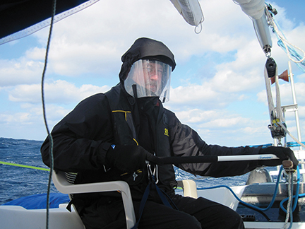
I donned my gear and climbed into the cockpit, blasted by wind and rain. It was pitch black. I could see Tyler’s outline, but nothing else. No sky, no ocean, no boat outside the cockpit—nothing. I was awake, but disoriented and uncomfortably disconnected from the boat, so I sat back for a moment and watched Tyler steer. He was sitting in one of our watch seats fashioned from outdoor plastic patio furniture with the legs cut off. This simple chair, with back and arm support, would facilitate our continuous hand-steering for three days. Confused when I saw little connection between his exaggerated arm motions and the movement of the boat, I asked, “How are you steering?” As the rainfall intensified, Tyler smiled behind his face-shield and said, “I think I’m getting the hang of it. It’s all by the feel of the tiller.” Though our world seemed mounted to a high-speed elevator, cycling up and then down, the pitch and yaw motion of the boat was fairly controlled. It felt, well, like we were on rails. I glanced at the depth/speed instrument and saw 8.6 knots, which was pretty good, I thought. Then I blinked my eyes and read it again: 18.6 knots. No wonder it felt like we were on rails—we were moving fast! We had three reefs in the mainsail and storm jib flying.
The winds were now 35 to 45 knots, and in different wave conditions, I might have been tempted to keep the hull planing and just let the horses run. But this was not the time to try to win a race. It was time to reduce sail even further. Tyler turned the boat close to the wind without tacking and, at my command, released the main halyard. The mainsail slid easily down the Tides Track System and came to rest in the general vicinity of the boom. Religiously attached to the boat with harness, lanyard and jackline, I moved out into the black void surrounding the boom and lashed down the sail. Tyler eased pressure on the tiller, allowing the solitary storm jib to pull us back onto an easterly course with the seas again on our port quarter. I inspected the foredeck, mast and rigging to make sure nothing was amiss before returning to the cockpit and a very disappointed crewmate. He had actually been enjoying the high-speed ride! Compared to the previous excitement, everything was now moving in slow motion. We were making 6 to 9 knots with little tendency to surf. Nothing for me to do then but let Tyler get some sleep while I relaxed and sailed the boat. In the next hours, the rain stopped abruptly and a brilliant full moon appeared to show us our world. I kept a close eye to our port quarter, adjusting course to an endless column of shadowy monsters rolling by.
THE HOME STRETCH
At first light of Day 3, with north winds still blowing between 25 and 35 knots, Tyler awoke and returned to the cockpit with a warm washcloth and two cups of café mocha. We sipped our coffee and took in the beauty and power of it all.
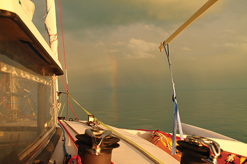
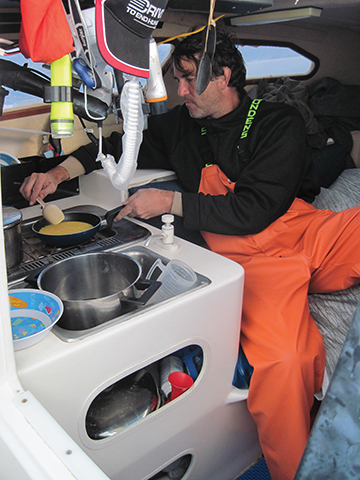
The next three days were fantastic and a bit blurry. We improved our quality of life by rigging the Lexan dodger and the bimini and installing our beloved Mr. Otto (pilot). We studied the progression of heavenly bodies across the sky and dolphins across our bow. We lost three lures, were slapped in the face by flying fish and gave safe harbor to a solitary exhausted blackbird who, after a night’s rest, demanded to continue his perilous journey across the ocean. We focused on paying close attention to the world around us and sought harmony with forces much bigger than ourselves. If materialism is a sickness, then the experience of sailing across an ocean must be the cure. Finally, just east of 70W longitude, we turned south onto our final leg. All our efforts to this point were rewarded with two days of beam reaching—as good as it gets.
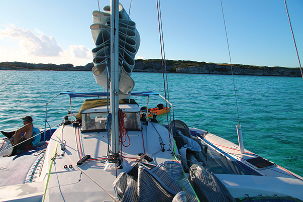
On Day 6 in the early afternoon, Tyler sighted land. Soon thereafter, my wife smiled and shared the news with her co-workers after reading my simple SMS message: “Land Ho.” As the water lightened to a spectacular shade of pale blue near shore, I released the daggerboard downhaul and rigged the rudder to “kick-back.” The boat was in shallow water “Jeep” mode with a sailing draft of 2.5 feet. If the Linda O. needed to prove herself in deep ocean, there was no need to do so here. She was made to explore every inch of these shallow, coral-strewn waters.
We dropped anchor directly off the beach by South Dock Grand Turk to find soft sand underfoot. Tyler and I swam in the crystal clear water, charged our batteries for the first time and took a shower using a hand-pressurized sprayer and hot water from the thermos. With the beach absolutely devoid of human life, we decided to wait for morning to clear in with immigrations. No worries, as we could both use a bit of rest. At 9pm that evening, my mind was swirling with images of our trip mixed with mental attempts to plan the days ahead, when suddenly my world of blue went completely black. I fell into a deep sleep without any dreams at all. I was living them now.
John King is a retired submarine officer with more than 30 years of nautical experience stretching from the lakes and rivers of his youth to every ocean and most of the seas. He lives with his wife near Galveston, Texas and enjoys sailing, offshore racing and adventure/travel of all sorts.
SMS WEATHER MESSAGES
Our SMS solution for getting offshore weather reports worked well and gave our shore support crew (our wives) a way to contribute to our safety and offshore decision making. We chose to rent an Iridium 9555 satellite phone with DC charger. It required one hour of charging per day and had clear reception below decks. With an SMS limitation of 160 characters, we crafted a condensed message format that was sent to us twice a day containing wind forecast and potential gale conditions tailored to our location and direction of motion. Upon reading the message, we did not need to consult any other reference to fully understand the implications.
We found that using GMT times and Beaufort force numbers minimized miscommunication and eased the burden of transcribing Internet weather resources into transmittable data. We practiced sending these messages for 10 days prior to getting underway, which was key for the reader to understand the intended message. If you use this system on your own voyage, you will likely come up with your own format, but below we present a sample message that we received:
RpLastSpot1106Z @GC! @CloseMovSE @TSNE2NMmovNE @WD @rpAndP3nwF7 @Settle @1122ZnwF5 @1206nF4 @ThenStable @Spot111035Z
Decoded: Using a reference position of your last SPOT report and the 11 November 0600Z NOAA weather information, here is your weather report. (Break.) Gale warning from an approaching cold front. Since no predicted arrival time is mentioned, it is assumed to be arriving in the next six hours. (Break.) The front is moving SE (Break.) Tropical Storm Sean is 200 nm NE of the reference position and is moving NE. (Break.) Wind forecast follows. (Break.) 12-hour forecast (1800Z) winds between your last SPOT location and route waypoint number 3 are NW Force 7. (Break.) Winds should eventually settle down after the front passes. (Break.) By 11 November at 2200Z the winds should be NW Force 5. (Break.) By 12 November at 0600Z winds should be N at Force 4. (Break.) Winds should be stable for a while. (Break.) Your last received SPOT position was dated 11 November1035Z.