


Funny how the beginning and end of a voyage can parallel each other, even when they’re three years and thousands of miles apart (published April 2016)
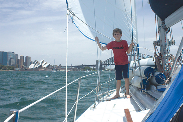
In 2011, when I set off from the U.S. East Coast for Panama with my husband and eight year old son, the greatest complicating factor for our Caribbean-bound trip was crossing the Gulf Stream.
When we set off on our final offshore passage, from Sydney to Brisbane, in 2014, the East Australia Current posed a similar challenge to our 1981 Dufour 35, Namani. By then, we knew enough to go with the flow when forces of nature are concerned, but it seemed that we were in for a little reminder all the same.
Why Sydney to Brisbane? After three years of magical Pacific cruising, the time had come to sell our boat and head back to work, and Brisbane has a reputation as a hub of boat sales. After a month of fun and games in Sydney—with Christmas barbecues, New Year’s Eve fireworks, and the spectacle of the Sydney-Hobart race start—it was time for us to get down to business and head north.
We’d gained first-hand experience with the East Australia Current (EAC) six weeks earlier, having made landfall midway along the coast in Coffs Harbour, then sailed south to Sydney. We had observed the south-setting current race at three or more knots and knew its effects can be felt well offshore. The tricky thing is that the EAC is not a simple one-way flow but a series of eddies that are constantly in flux. Generally, the south-setting current stretches about 250 nautical miles offshore, but there are patches and even entire corridors of north-setting current in between. The chances of catching a north-setting ride are also good on the eastern side of the EAC, especially once you get 150 nautical miles or so offshore.
With this in mind, we developed a plan—a good plan, or so we thought —for heading north. The idea was to head well offshore and ride eddies to our advantage over the 500 mile passage. In doing so, we’d be bucking conventional Ozzie sailing wisdom that calls for sailing north with “one foot in the sand”—that is, skirting the coast where the contrary current is at its least or even reverses. We weren’t keen on that idea, having observed how closely freighter traffic hugs the coast. By heading offshore, we reasoned, we could find north-setting eddies and avoid the inshore shipping that had given us so many headaches on our previous trip south—well worth the price of a detour. We’d had weeks to observe the weather and wait for the leading edge of a stable high pressure system to move in, providing a steady flow of southeasterlies so that we could make the trip in one six day run.
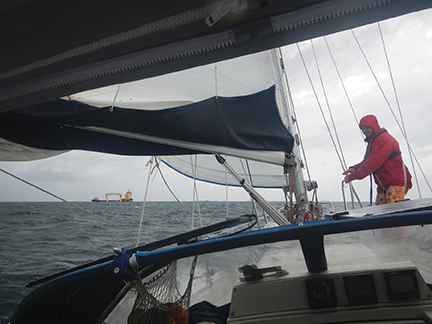
It was a beautiful plan—except it didn’t work. Once we had our weather window, we set off, confident of our logic. But the forecast southeast wind had a lot more east than south in it. So much, in fact, that at times it even tended ENE—not a good thing along this northeast tending section of the Australian coast. Combined with an adverse two knot current, the wind was such that all Namani could manage over ground was a two knot crawl of a close reach. Blue skies gave way to grey and the swell grew throughout the day, inching toward the three meter mark. The only good news was that our stomachs were handling the transition back to blue water well.
Several frustrating hours later, we had to admit that another great plan had gone to the dogs. We were neither inside nor outside the EAC: we were smack in the teeth of the beast with easterly winds blocking any prospect of making it to the other side. That’s when we decided to call it quits and head to Port Stephens, 90 miles north of Sydney, where we could mentally regroup and form a new plan. By this point in our sailing careers, we’d learned that flexibility comes ahead of stubbornness every time. We still had a frustrating night of tacking and cursing ahead of us as we dodged one ship after another. The main obstacle was the shipping off Newcastle, a bustling coal harbor. Little good our AIS receiver did us with a dozen ships in close quarters! A handful were anchored, while others drifted, awaiting the harbormaster’s summons, and still others steamed to and fro. At one point, I was forced to put Namani on a port tack and head 195 degrees to avoid one. That meant heading away from our destination at a clip of four knots, well above our speed made good in the desired direction!
24 hours after departing Sydney, we finally reached Port Stephens, one of the few all-weather ports of refuge along an inhospitable coast. Inside its bold headlands, Port Stephens cuts a deep cleft into the mainland, branching into several arms that offer excellent shelter. We’d already visited the area on our earlier trip south, when we’d taken refuge from a Tasman Sea gale in North Arm Cove. This time, conditions were moderate enough for us to simply duck into nearby Shoal Bay, drop the anchor, and give ourselves a night to sleep on things. Happily, there was no need to rush into any decision, since we could count on the stable weather pattern to provide moderate southeasterlies over the coming days.
Morning and a good night’s sleep brought clarity to our minds, and we resolved to grit it out on the inshore route despite the heavier shipping traffic. We did hang on to our original hope of tackling the remaining distance in one shot if possible. While there are a number of small harbors between Sydney and Brisbane, most lie behind shallow bars, making entry a tricky proposition in all but the most favorable points of tide. This point was dramatically illustrated in our cruising guide (Alan Lucas’ excellent Cruising the New South Wales Coast), with its images of fishing boats floundering in massive standing waves after missing the tide. Alan Lucas also makes a point of detailing every shipwreck along this coast, with long lists of macabre facts that fill the margins of nearly every page. We took his point to heart and resolved to make as few stops as possible for simplicity’s sake. After months on the go, Markus and I could slip in and out of our four hour watch keeping schedule easily. Nicky had no qualms about blue water, either, so we set off again, somewhat wary of what our new plan might bring us.
SAILING THE EASTERN AUSTRALIA CURRENT
The strongest flow of the EAC usually occurs between Sugarloaf Point (25 miles north of Port Stephens) and Smoky Cape (another 100 nautical miles to the north), so we’d have to keep closer to shore than we would have liked—within three miles, give or take. At least the swell had settled back down, giving us an easier ride. Geography was on our side, too: as soon as we rounded Sugarloaf Point, the coastline angled slightly more north. We’d still be heading northeast, but even a few degrees gained would make our course more tenable, especially with the wind slowly backing from east to east-southeast.
Soon, things were looking up, and we were feeling good about our decision to stay inside the 100 fathom line. Our unplanned stop in Port Stephens helped us make the mental shift needed to embrace the inside route, and a sunny day didn’t hurt, either. Now Namani was sailing a good six knots to windward, practically racing along the coastline in comparison to the previous day. We passed Captain Cook’s Tacking Point, relieved to be able to clear the cape in one try. Although the idea of staying inshore felt claustrophobic at first, I came to see it as an advantage. The land side was predictable and our route well-charted; it was the ships that were a problem, and staying inshore left them all to starboard, keeping our port side clear.
Namani made such good speed that we realized we might get ahead of ourselves. If the good times lasted, our eventual arrival in Brisbane would be at nighttime—not an enticing proposition given the shoal-ridden approach to Moreton Bay. In the second snap decision of the trip, we hung a sharp left and pulled in to Coffs Harbour 36 hours after leaving Port Stephens, just beating the setting sun in. We much preferred a night at anchor to a night heaving-to among ships, so we grabbed the chance at a solid night’s sleep before continuing on to Brisbane, 235 miles away. We knew the layout of Coff’s Harbour by heart, having initially cleared in to Australia there: the jetty, the breakwater, and the marina to one side. We dropped the anchor in 18 feet and immediately treated ourselves to a quick dip in the water, followed by a fresh water shower and a hearty dinner. Our one regret is that we couldn’t go for a rejuvenating swim. Just six weeks earlier, a surfer had been killed by a shark in the immediate area.
On our last visit, we’d spent two weeks in Coffs Harbour waiting for a weather window to head south to Sydney. Then as now, we ended up tackling the distance in several hops. This time, we had the luxury of a stable weather system, unlike the very short windows of opportunity of our previous trip. Still, we made it a quick pit stop and headed out early the next morning for a final push north. In contrast, leaving Sydney had been a much harder proposition, at least mentally. I always get a case of the nerves about heading offshore after a few weeks close to land. The minute I head out, however, the butterflies are gone with the wind.
Thus far on this trip, we’d sailed 24 hours, stopped for a night in Port Stephens, then sailed another 36 hours before stopping for another night off—quite the comfortable schedule, as it turned out. We did, however, hope to make the remaining distance in one long hop, although we did note alternative pull-in points such as Yamba, at the mouth of the Clarence River, and Ballina, on the Richmond River. We were in no rush to conclude our final voyage afloat, but neither did we want to drag out the inevitable.
As we bid goodbye to New South Wales and watched southern Queensland slide into view, it seemed as if shipping traffic thinned. Fishing boats were out in full force, though, including slow trawlers that tangoed left, then right, then left again. By day, their movements were easier to predict. We could relax more and watch the coast roll by, thinking of Captain Cook discovering this continent and its people for the first time. It’s not the most inspiring coast, however, with dun-colored hills marked only by the odd beacon or jutting cape. At night, the mainland was as dark as the sea, with only occasional clusters of light marking lonely outposts at the edge of civilization. The view above was more interesting: the Centaur reared, almost trampling the Southern Cross, while Orion cartwheeled overhead. We watched their antics with renewed interest, knowing our southern hemisphere sojourn was gradually coming to an end.
APPROACHING LAND AND THE END OF THE JOURNEY
Now that we had found our rhythm again (and were making good speed as long as we remained inshore), it was a pleasure to watch time tick by, so unlike the rushed hours of our lives on land. With our sturdy boat, a cooperative wind, and each other, we felt we had it all. The moon was gradually waxing from quarter phase to a plump gibbous shape; that and a good book was all the entertainment we needed over the next two days and nights. Land provided fewer distractions, except for a few more distinctive mountains and the stiletto skyline of Surfer’s Paradise, a Queensland milestone. Each mile brought us closer and closer to Brisbane. Soon, it was time to plan our approach.
The city of Brisbane lies behind two barrier islands, Stradbroke and Moreton Islands, which protect Moreton Bay, an area of sand banks and shallows. Although a narrow cut between the islands tempts some sailors to shortcut into the bay, we took Namani and her six foot draft up and around both islands to follow the marked shipping lane into the bay. We had to fight a two knot current on the way, but by this point, we had hours of daylight on our side. One by one, we ticked off the buoys marking the channel, keeping red to left as is the rule throughout most of the Pacific. What was unusual was having navigation aids at all. In most places we’d visited since departing Panama, a crooked pipe stuck into the corner of a reef had been enough of a navigation aid to celebrate—here, we had real buoys to steer by.
We wound our way through ribbons of pastel greens and shallow blues, astounded at the size of the freighters maneuvering through the aquamarine maze. To make the most of our remaining hours at sea, we took to hand steering. It had been our plan all along to sell Namani in Australia, but the reality was truly upon us now. Soon, we spotted a forest of masts of boats within Scarborough Boat Harbour, located in a suburb of Brisbane. When we made Namani fast in her berth, we knew that our days of calling ourselves sailors were numbered. The following week was a flurry of beautification work to present the boat at her best, and we found a buyer within a few weeks. That part of the trip, at least, had gone according to our original plan.

If nothing else, three years aboard Namani has taught us to be flexible. This start-and-stop passage from Sydney to Brisbane wasn’t the first to bring a few surprises. Our battle with the EAC proved more complicated than our Gulf Stream crossing several years before, but without the spectre of adverse weather breathing down our necks, we had the luxury of time. A few days later, the prevailing high pressure system gave way to a troughy mess, so we were happy to have made the trip when we did—especially as the EAC intensified, sweeping south along at three and even four knots. That would have been hard to beat!
One final, welcome surprise awaited us at the end of our trip. Namani’s new owner wanted the sloop delivered 800 miles farther north to her new home port of Cairns—and was willing to give us several more months aboard in exchange. One final adventure awaited us after all. All along, we’d thought this trip would be our last and once again, we were wrong—in the best possible way.
Nadine Slavinski is the author of Lesson Plans Ahoy: Hands-On Learning for Sailing Children and Home Schooling Sailors. Together with her husband and young son, she cruised the Atlantic and Pacific aboard her 1981 Dufour 35, Namani. She is currently at work on The Silver Spider, a novel of sailing and suspense, as well as Pacific Crossing Notes: A Sailor’s Guide to the Coconut Milk Run (see nslavinski.com for more information and free resources on home schooling).