• Home
  • Cruising Compass Media Advertising & Rates
  • Blue Water Sailing
  • Multihulls Today
  • Contact Us
  • Subscribe Today
Cruising Compass
Dock Talk 0

Saving Lives: NOAA’s Satellites Used to Detect and Locate Distress Signals

By Sandy Parks · On January 31, 2020

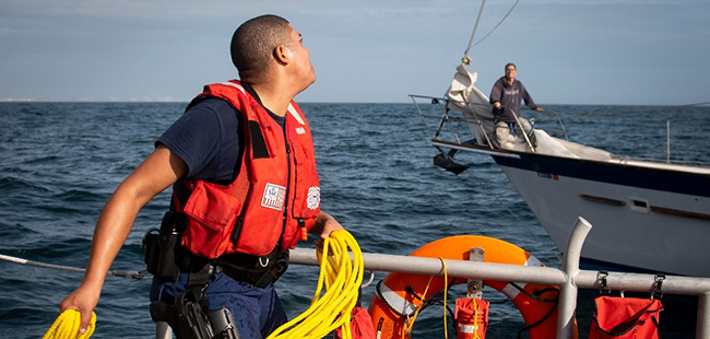
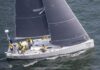
There were 306 water rescues in 2019 and NOAA’s satellites were there to pinpoint the location. The information received is sent to the SARSAT Mission Control Center at NOAA’s Satellite Operations Facility in Suitland, Maryland which then passes on the information to the U.S. Coast Guard. Read More

Share Tweet

Sandy Parks

You Might Also Like

  • Dock Talk

    Mindbender

  • Dock Talk

    Survey of the Week

  • Dock Talk

    Cruising in the Time of War

Recent Posts

  • Safety at Sea Experts Investigate Yacht to Yacht Rescues

    March 19, 2026
  • Mindbender

    March 18, 2026
  • Survey of the Week

    March 18, 2026

Please Visit Our Sponsor’s Webpages


  • Home
  • Media Advertising & Rates
  • Blue Water Sailing
  • Multihulls Today
  • Archives
  • Contact Us

Published by Blue Water Sailing Media, a division of Day Communications, Inc., Middletown, RI

Publisher & Editor: George Day

Blue Water Sailing Media publishes Blue Water Sailing magazine, Multihulls Today and other titles.

Cruising Compass Advertising Sales:

George Day, Newport, RI
george@bwsailing.com
401-847-7612


Recent Posts

  • Safety at Sea Experts Investigate Yacht to Yacht Rescues
  • Mindbender
  • Survey of the Week
  • Mindbender
  • Survey of the Week
  • Update on Indian Ocean Crossings This Spring
  • Survey of the Week

Search

© 2014 Blue Water Media. All rights reserved. | Admin