


A sailing route less traveled by made all the difference (published September 2016)
We continued our beat to windward, leaving Isla Saona, Dominican Republic for Puerto Rico. Crossing the southern end of the Mona Passage, one of course has to pick a good weather window. We set waypoints for clearing the reefs around the west and southern sides of Isla Saona and weighed anchor at 8:00 a.m taking our best tack to gain way to the east. The seas calmed quite a bit as we entered the deeper water east of Isla Saona, entering the Mona Passage proper. We set more lures out to rinse behind the boat—that is all they seem to be doing so far on this trip besides catching the occasional barracuda. Good thing we still had some frozen fish left from Isla Beata.
The crossing of the Mona Passage was uneventful and largely free of traffic except for a U.S. Coast Guard cutter that crossed northbound as we approached Isla Mona. By 8:00 p.m we had cleared Isla Mona.
Sailing east to Puerto Rico sailors commonly clear in at Mayaguez, either anchoring there or in Boquerón. But once there, rounding Cape Rojo on the southwest corner of Puerto Rico can present a significant challenge. This cape, with it steep rock cliffs, can become impassable when the winds build from the east. We decided instead to bypass the west coast altogether and make for Ponce directly where we were at anchor by 11:00 a.m. Clearing in, having registered with the Local Boater Option while at a SSCA GAM last November, was just a matter of phoning in from the phone dedicated to the purpose at the Ponce Yacht and Fishing Club, though we had to wait about 30 minutes for a call back from the officials. We enjoyed the air conditioning while we waited.
PONCE
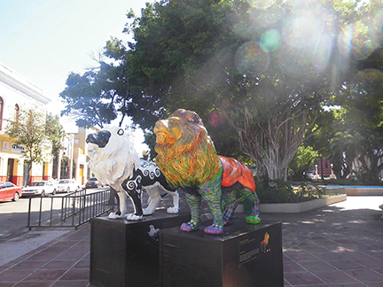
The anchorage at Ponce averages 30 feet deep so we swung on 200 feet of chain in harmony with the other boats around us while the Malecon at the north end of the anchorage provided the music from early morning and afternoon open-air Zumba classes to late afternoon drum circles in the parking lot which ran well into the evening. We found a public dinghy dock at the east end of the Malecon, locked the dinghy, and it being a good walk to just about anything, were able to get a local to call a taxi for us. An eight dollar fare took us to the mandatory tourist area, dropping us right in front of the famous Parque de Bombas (fire station) which is back-to-back with the spectacular Cathedral of Our Lady Guadeloupe, just off the Plaza las Delicias. The driver was quick to point out the best ice cream was to be found in the storefront right across the street from the fire station. He was right. We enjoyed ample portions while people and pigeon watching at the Plaza.
Ponce had been marked for “deep re-provisioning” on our itinerary since we left Florida. You can get just about anything here and shop in familiar stores though there are some notable local stores worth considering for case lot buys such as Hermanos Santiago Cash and Carry, a few blocks east of the K-Mart, Walmart, and Home Depot. Taxi required for return trip.
ISLA CAJA DE MUERTOS
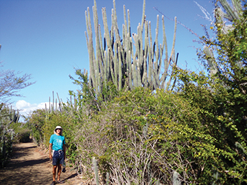
Fulfilling our “big city” needs, we were ready to return to quiet anchorages. Isla Caja de Muertos (Coffin Island), about seven nautical miles away, with tacking, 14.5 nautical miles away, fit the bill. This state park offered hiking up to the lighthouse built in 1887, an underwater snorkeling trail, and a swim beach well-sheltered from the prevailing winds and ideal for Jill to enjoy some long lap swimming. The trail to the lighthouse is first pretty flat and lined with amazingly tall saguaro cactus then proceeds at a fairly steep grade to the summit. Please join us in appreciating the park rangers who carried a full set of new batteries up that hill to restore the light while we were there.

It was hard to leave the beauty of this island but we pressed on, back to civilization and the bay at Salinas, a bay that seems to capture and hold a lot of boats for the long term. It is certainly a good hurricane hole and popular place for part-time cruisers to leave their boats for months at a time. The marina there is very friendly and is the last convenient stop for fuel at great prices before proceeding east to the Spanish, U.S. and British Virgin Islands. We also received some care packages from our daughters via general delivery at the post office. When traveling through U.S. territories, Priority Mail to general delivery makes getting parts or sending things back to the U.S. very economical. We made such arrangements at St.Thomas and St. John as well. It’s a very long walk to get propane tanks filled at Light Gas, but as we experienced throughout Puerto Rico, it was not long before a local saw us walking and hauling and offered us a round trip ride, eager to tell us of their times in the U.S.
One of the best parts of cruising is meeting couples and families from all over the world and often re-encountering them in new ports. We enjoyed visiting with French and Swiss couples heading in opposite directions. For those heading west, we were happy to share information, experiences and resources. Those who had been east did the same for us. In either case, we also often learned some new cocktail recipes.
Short hops became de rigueur on the south coast of Puerto Rico and Vieques. Just a few miles from Salinas, we enjoyed a calm anchorage behind Boca de Infierno amongst the mangroves. A few miles further on brought us to Puerto Patillas where we enjoyed a few meals at local restaurants while we sat out some fairly strong winds, rolling a bit and wishing we had stayed longer at Boca del Infierno. With all the rain showers we experienced here, we renamed this bay “Rainbow Bay”.
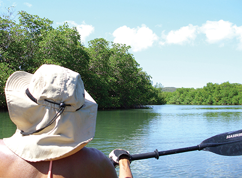
Leaving the main island of Puerto Rico, we started off tacking southeast to make the southern coast of Vieques. As the winds backed, tacking, we found ourselves on a perfect line to make the beaches south of Punta Arenas on the west end of Vieques. Change of plans for the better. Here we first launched our inflatable tandem kayak and enjoyed the snorkeling near Punta Bermudes on a healthy reef teaming with yellow and purple sea fans and plenty of fish. In the lee of the island, it was a restful anchorage after the spirited winds and seas of the brief crossing from the “mainland”.
Continuing our theme, we proceeded to Ensenada Sun Bay on the southern side of Vieques, bypassing the nearby town of Esparanza and its more crowded anchorage. Going east we started on a tack of 170-180 degree magnetic, knowing the winds would back a bit as we proceeded and, with the waves and current, that we would have a fast tack “up” the coast when we did tack. As it turned out, the winds died on us and we had to motor the last few miles of the 11 nautical miles hop.
Ensenada Sun Bay was one of our favorite stops, starting with a quick swim which yielded some conch for appetizers. Getting the critters out of the shell and cleaning them has become easier with the occasional practice afforded us through the islands. It really just takes practice once you learn the basics. Besides the beautiful beach here, the bay with the highest density of bioluminescence in the world is less than three fourths of a mile down the road, Puerto Mosquito. There are plenty of businesses that will take you to the bay and provide a kayak and guide for about $50 per person. We decided to go it on our own, carrying our inflatable kayak down the road at sunset. Despite a fairly bright moon, the bioluminescence was fabulous. This is a stop not to miss but you can neither anchor in the bay nor take any gasoline-powered dinghies there. We paddled around the bay for a few hours, managing to avoid some of the flash photography from the tour groups. Not only were we $100 richer, but we ended up with a better story to tell about carrying the Kayak on our heads down the road with its slippery muddy spots, and using our own kayak, we were able to stay a lot longer than the tour groups allowed.
PUERTO FERRO
To the east of Ensenada Sun Bay and Puerto Mosquito is Puerto Ferro, said to be another bioluminescent bay. The entrance to the bay is a little tricky so make sure you have a chart that details the rocks and depths well. As we approached the bay, we had strong seas with dolphin jumping out of the waves. They always seem to come our way to caution us of something tricky ahead. We saw no less than eight feet through the narrow channel but the depths were just a few feet on either side of the channel. We carried the mainsail in until we were ready to anchor. An engine glitch here could be precarious but with good charts and some visual piloting, the entry was a pleasure under sail. A manatee gave us a flip of its tail as if to acknowledge its approval as we cleared the narrows.
We ended up with Puerto Ferro all to ourselves save the few empty boats anchored there for the long term. We dropped the kayak again and rowed through the mangroves where a few blue water equipped boats lay tied up, abandoned, and largely stripped, the skeletons of dreams past, fulfilled or not we will never know. That evening we kicked our feet in the water but saw no bioluminescence where we were anchored. Having spent so many hours enjoying the best there is at Puerto Mosquito just the night before, we decided not to go seeking more in the mangroves.
From Puerto Ferro we took an early morning, 75 minute hop down to Bahia de la Chiva (Goat Beach). This is another beautiful beach but was at the time a very rolly anchorage. We launched the kayak to enjoy a tour of the bay and a walk on the beach. No goats were sighted. Considering the anchorage fairly uncomfortable under the current conditions, we moved on to the Ensenada Honda, one of three bays with this name that we encountered in Puerto Rico, the others at Roosevelt Roads and on Culebra. This is a long bay that was part of the former bombing range that previously occupied most of the west end of Vieques. Up on the hill, the highest point on this end of the island, is an abandoned red and white checkered control or observation tower but otherwise there are no other signs of civilization here. Now it is all a nature reserve and we could not see any signs of bombing other than the unexploded munitions warning signs in several places. This anchorage was very calm but afforded us a good breeze which kept any mosquitos or no-see-ums from bothering us. The water here is a gorgeous turquoise but has a high level of suspended matter making the visibility through the water only a few feet. There was no snorkeling to be had but the bird watching and listening made for a special evening with only two other boats distant in the bay.
The next morning we started our crossing to Vieques. Once again we began by sailing in precisely the opposite direction, heading 170 degrees magnetic for three and a half nautical miles for an island northeast of us. This tack proved ideal as we tacked back to round Punte Este on a close reach and fell off for a beam reach right into Ensenada Honda on Culebra, sailing most of the way up the bay. Though the reflected waves made the shallow seas pretty rough until we cleared the north end of Vieques, this was perhaps our best day of sailing yet. A tuna found one of our well rinsed lures attractive but unfortunately I failed to keep him hooked long enough to have him join the crew.
Culebra is worthy of a several day stop which quickly became a full week as we waited out strong winds and tall seas. Dewey is the town on Culebra and just goes by the name “Culebra”. The bay is long and mostly deep. We anchored in 18 feet and over the week watched plenty of boats come in and drag anchors around on short scopes. Nine feet can be found at the north end of the bay but that seems to be a bit too far from the Dinghy Dock bar and restaurant for most folks.
Culebra offers beaches and snorkeling on all four sides. Despite the weather, we enjoyed a lot of both on several days. Off the west coast is a park reserve island where we found some of the best snorkeling. To access the west coast, one can dinghy through the east-west canal, under the no longer operating, but brightly painted lift bridge. At the west end of the canal is the ferry dock. The local stores and restaurants all provide an advertising map which shows all the snorkeling and diving spots. The most famous beach, which many guides call the most beautiful in the Caribbean, is Flamenco Beach on the north side of the island. It’s a fair walk (much more than the “mile” mentioned in the guides) or a three dollar per person ride on one of the buses. The beach itself could be over a mile long. If you didn’t bring one, rent an umbrella and hang out for the day. Even on a Thursday it was a pretty hopping place but very family oriented. Remnants of the bombing range on this island can be found in the bombed out trackless tanks near the west end of the beach. For other entertainment, a short walk to the airport provides great aerobatic displays as pilots swoop in through the cut between the hills, turn, dive, and slip down to the short runway. The rush hour for these planes starts at 4:00 p.m.
With the seas calming from eight feet with a seven second interval, and the winds down from 20 knots gusting to 30 knots, we found a chance to transit the east end of Culebra to Culebrita, another “don’t miss” stop. We decided to risk a rolling anchorage in order to get some time here before leaving the Spanish Virgins for St. Thomas. The anchorage was not as rolling as we expected and the beach was one of the nicest we had seen anywhere so far. The DNA moorings here are marked for day use only but many saw overnight use with few anchoring. On the northeast side of the bay we found “The Jacuzzis”, a relatively calm tidal basin full of fish fed by crashing waves from the north.
All in all, Puerto Rico exceeded our expectations and we certainly recommend the southern coast of the main island and Vieques for cruising while Culebra is definitely a “don’t miss”. Puerto Rico is also, as we anticipated, a perfect “deep provisioning” stop before the Virgins and the best we found again before Saint Martin/Sint Maarten. Don’t rush by these islands on your way south.
Over the last several years we have watched Pete and Jill Dubler’s restoration and refit of their Pearson 424. In December, they began their new life as cruisers aboard S/V Regina Oceani.