The National Oceanic and Atmospheric Administration (NOAA) plans to cease support for producing the 1,000-plus NOAA charts that millions of boaters use and rely on for safe navigation.
NOAA decided to privatize the printing of NOAA paper charts several years ago by certifying private companies to print official NOAA paper charts. A 2014 article published on their website was entitled: NOAA’s Paper Nautical Charts are Here to Stay, New certified printing agents bring buying options. In the article, the former director of NOAA’s Office Coast Survey (OCS) said: “We asked private companies to help us transition from the government-run system to a robust and competitive market for paper nautical charts, and we are pleased with the results.”
Despite the decision to privatize print chart production several years ago, NOAA has released a National Charting Plan that calls for ceasing production of the images used to print the charts. The action will have a profound effect on recreational boating.
After the 2017 National Charting Plan was released, the current director of OCS was quoted in a media account as saying that it was “a major pivot point at OCS” and that “the paper era is finished.”
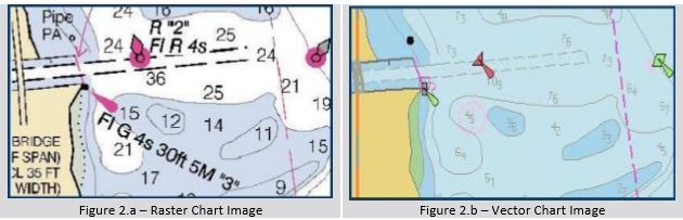
NOAA’s Raster PDF images are the sources for publishing print products that are widely used by coastal recreational boaters in conjunction with electronics, such as waterproof charts, chartbooks and cruising guides. NOAA also proposes to eliminate the electronic raster nautical chart (also known as BSB) files that are used by many software systems and navigation plotting systems. . The change sought by NOAA is due to its use of Electronic Nautical Chart (ENC) data, which consists of layers of vector data designed for use in expensive commercial Electronic Display Information Systems (ECDIS). The ENC database is designed for commercial use and does not contain all of the detail available in NOAA paper charts or raster nautical (RNC) charts in areas that are not frequented by commercial vessels.
Several private chart companies do an excellent job of reformatting NOAA data into vector databases that are widely used by U.S. boaters in chart plotters. GPS systems and chart plotters are incredibly useful but prudent mariners know that one should always have a set of paper charts on board for reference and backup in case of electronic malfunction or power failure. Virtually all boating safety and captain training schools teach plotting skills using paper charts in order to ensure safe navigation. Many boaters also prefer raster nautical chart (BSB format) files electronically due to the detail, look and feel of the traditional NOAA chart, and they match the charts on which they learned to navigate.
NOAA has done an exemplary job of producing some of the best charts available anywhere. It would be highly detrimental to boating safety and prudent navigation if they were to implement this proposal.
The last day for comments is June 1, 2017.
Please also contact your U.S. representative and senator to request that NOAA continue to produce the suite of NOAA charts that the boating community relies upon for safe boating.
NOAA National Charting Plan
USER FEEDBACK Professional mariners, recreational boaters, data providers, navigational equipment manufacturers, and other users of NOAA charts are invited to review and comment on the National Charting Plan. The plan may be downloaded from the Office of Coast Survey website at https://www.nauticalcharts.noaa.gov/mcd/docs/NationalChartingPlan.pdf.
How to Provide Comments on this Charting Plan
You are invited to comment on the National Charting Plan through NOAA’s Nautical Discrepancy Report System at http://ocsdata.ncd.noaa.gov/idrs/discrepancy.aspx

- Enter your e-mail address in the boxes provided.
- The form above will be displayed.
- In the “OTHER PRODUCTS” box, enter “NCP.”
- Enter your comments, suggestions or questions in the “DESCRIPTION OF DISCREPANCY” box or you may attach a .doc, .docx, .pdf, or .txt format file with your comments using the “Choose File” and “Upload File” buttons.
- Click on the “Submit This Discrepancy” button to complete your submission.
Feedback may also be sent to:
National Ocean Service, NOAA (N/CS2)
ATTN: National Charting Plan
1315 East West Highway
Silver Spring, MD 20910-3282