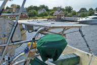
We used to call the digital chart readers we put on our boats chart plotters because that’s all they did, they allowed you to navigate on a digital screen using digital charts. When first introduced, chart plotters were revolutionary. Today, they are gone. The new devices built by the big names in marine electronics are now call multifunction displays because they are in fact digital screens that are linked to all of the marine electronics on your boat and are more like computers than chart readers because they can multi task and integrate data from all sources.
That evolution and the birth of the iPad and smart phones has led the way to the latest revolution in marine navigation and computing, multifunction displays in your hand and not bolted to the boat, which cost about a third of MFDs and can be taken anywhere. Digital chart provider Navionics was an early player in the app route to marine chart plotting and is still a big player.
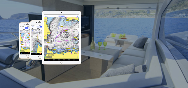
But iNavX has taken the concept and expanded it to the full multifunction level of built-in MFDs. The iNavX app, available in the Apple Store for iOS devices and the Play Store for Android phones and tablets, costs $24.95. Once installed, the app can access all of the NOAA chart library for free. That’s the chart plotter level of capability but the app can do so much more. The app also gives you access to a wide range of commercially available charts from around the world that can be downloaded for a fee right through the app. You literally can have the whole world at your fingertips.
The app in NMEA compatible so it can be linked via Bluetooth to all of your marine instruments, such as the speedo, depth sounder, win instruments and even the AIS transponder so all of these functions can be integrated into the app software and thus into your navigation. With a flip of a finger on the touch screen, you can page through all of your instrument readings. For marine electronics that are not Bluetooth compatible, the iOS version of the app can be linked to your instruments via a TCP/IP wi-fi multiplexer.
The actual navigation functions with the app on your phone or tablet are self-sufficient once the chart have been downloaded via the internet. So, you can sail anywhere you like as long as you have the charts. But, if you have wi-fi available, or you subscribe to an email weather service via a satphone or SSB, you can also download weather and wind files and forecasts that can be overlaid right on the charts.
Those who have used the iNavX app for coastal and offshore sailing rave about the ease of use, the high quality of the graphics and the full multi-function capabilities. For more information log on to www.inavx.com.