• Home
  • Cruising Compass Media Advertising & Rates
  • Blue Water Sailing
  • Multihulls Today
  • Contact Us
  • Subscribe Today
Cruising Compass
Tech Talk 0

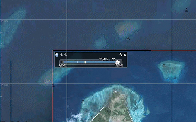
Navigating with Google Earth

By Sandy Parks · On December 6, 2019

(Yachting Monthly) – Meteorologist Chris Tibbs explains how useful Google Earth can be as you sail in areas far afield. He discusses using satellite imagery from Google Earth and how to overlay GPS coordinates for greater accuracy. Tibbs comments on open source CPN and various Apps to aid in navigation while bluewater cruising for both Apple and Android products. Read More
Share Tweet

Sandy Parks

You Might Also Like

  • Dock Talk

    PredictWind Offers Smart Data Control Hubs for Starlink Connections

  • Boat Rat's Tip of the Week

    Tach Talk: Diesel Diagnostics for Marine Engines with Hiccups

  • Dock Talk

    Is the New CayCube a Better Mouse Trap?

Recent Posts

  • Mindbender

    October 22, 2026
  • Survey of the Week

    October 22, 2026
  • Vision Catamarans Introduces New 484 Couple’s Cruiser

    October 21, 2026

Please Visit Our Sponsor’s Webpages


  • Home
  • Media Advertising & Rates
  • Blue Water Sailing
  • Multihulls Today
  • Archives
  • Contact Us

Published by Blue Water Sailing Media, a division of Day Communications, Inc., Middletown, RI

Publisher & Editor: George Day

Blue Water Sailing Media publishes Blue Water Sailing magazine, Multihulls Today and other titles.

Cruising Compass Advertising Sales:

George Day, Newport, RI
george@bwsailing.com
401-847-7612


Recent Posts

  • Mindbender
  • Survey of the Week
  • Vision Catamarans Introduces New 484 Couple’s Cruiser
  • PredictWind Offers Smart Data Control Hubs for Starlink Connections
  • Lessons Learned from a Damaging Collision with a UFO at Sea
  • Six New Boats Making U.S. Debuts at the Annapolis Sailboat Show
  • Sea Tales: Southern Ocean Wipeout on the Whitbread 1989

Search

© 2014 Blue Water Media. All rights reserved. | Admin