
Browsing Tag charts
-
Dock Talk 0
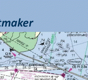
Charting Changes: NOAA’s Plans for the Future of Charts
Have you ever wondered why your depth sounder and chart do not agree on the suitability of a planned anchorage, or why all of the charts you have ...
-
Dock Talk 0
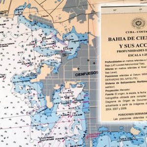
Cartography Lessons Learned Searching for the Best Charts of Cuba
Written for Panbo.com by Ben Ellison. Pardon my photography, but the point is that many detailed, up-to-date, and well-crafted official paper charts of Cuba do exist. Unfortunately, they’re ...
-
Website of the Week 0

Old Maps Online
Old Maps shows over 250,000 high-resolution historical maps from 15th to 20th century. Use the website or app to see your own GPS position on any of the ...
-
Boat Rat's Tip of the Week 0
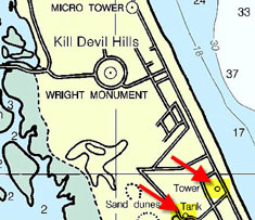
Do You Know About These Nautical Chart Accuracy Indicators?
By Captain John of skippertips.com. Turn on your chart plotter or study your nautical chart and you will see objects on land or water. But how accurate are ...
-
Dock Talk 0
NOAA Uses Crowdsourced Data to Improve Charts
The United States has about 3,400,000 square nautical miles of water within our coastal and Great Lakes jurisdiction. Coast Survey, who is responsible for charting that vast area, ...
-
Tech Talk 0
How Accurate are Nautical Charts?
NOAA announces that charts will provide more information on “zone of confidence”. It is a major challenge – some might say an impossibility – to keep all thousand ...
-
Dock Talk 0
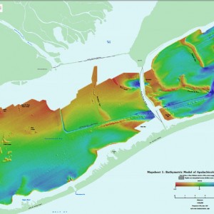
NOAA’s Tiny Boat Drones Map The Ocean’s Shallow Floors
What shoreline knows not our maps? Most of them, it turns out. While satellites map much of the globe on a daily basis, there are parts of the ...


Please Visit Our Sponsor’s Webpages


