• Home
  • Cruising Compass Media Advertising & Rates
  • Blue Water Sailing
  • Multihulls Today
  • Contact Us
  • Subscribe Today
Cruising Compass
Dock Talk 0

NOAA Uses Crowdsourced Data to Improve Charts

By Administrator · On June 23, 2016

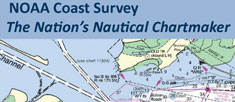
The United States has about 3,400,000 square nautical miles of water within our coastal and Great Lakes jurisdiction. Coast Survey, who is responsible for charting that vast area, averages about 3,000 square nautical miles of hydrographic surveying each year. The data collected by those surveys update over a thousand NOAA charts. However, hydrographic surveys are expensive and laborious, and so Coast Survey directs them toward the highest priority sites, which leaves many coastal areas without updates for many years. Read More

BathymetrychartsCrowdsourcingNOAA
Share Tweet

Administrator

You Might Also Like

  • Dock Talk

    Survey of the Week

  • Boat Reviews

    Allures Introduces New Aluminum Horizon 47

  • Dock Talk

    Salty Dawgs Announce 16th Fall Caribbean Rally

Recent Posts

  • Survey of the Week

    June 10, 2026
  • Mindbender

    June 10, 2026
  • Allures Introduces New Aluminum Horizon 47

    June 10, 2026

Please Visit Our Sponsor’s Webpages


  • Home
  • Media Advertising & Rates
  • Blue Water Sailing
  • Multihulls Today
  • Archives
  • Contact Us

Published by Blue Water Sailing Media, a division of Day Communications, Inc., Middletown, RI

Publisher & Editor: George Day

Blue Water Sailing Media publishes Blue Water Sailing magazine, Multihulls Today and other titles.

Cruising Compass Advertising Sales:

George Day, Newport, RI
george@bwsailing.com
401-847-7612


Recent Posts

  • Survey of the Week
  • Mindbender
  • Allures Introduces New Aluminum Horizon 47
  • Salty Dawgs Announce 16th Fall Caribbean Rally
  • Transatlantic Record Attempt Foiled on Second Day
  • Mindbender
  • Survey of the Week

Search

© 2014 Blue Water Media. All rights reserved. | Admin