• Home
  • Cruising Compass Media Advertising & Rates
  • Blue Water Sailing
  • Multihulls Today
  • Contact Us
  • Subscribe Today
Cruising Compass
Dock Talk 0

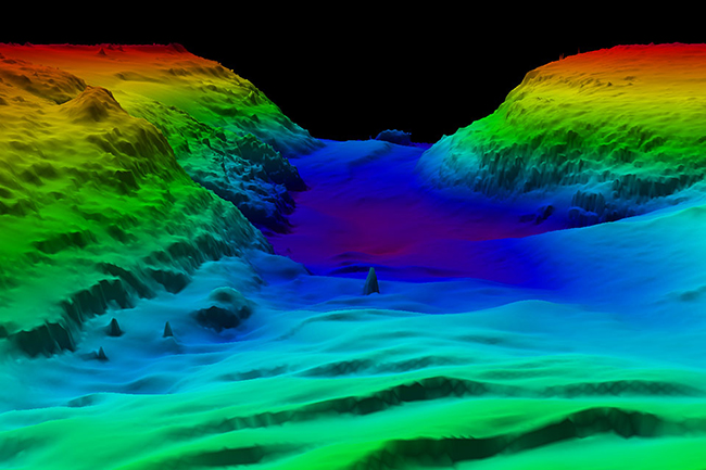
Mapping the Ocean Floor

By Sandy Parks · On July 7, 2022

Last month NOAA formalized U.S. participation in the The Nippon Foundation-General Bathymetric Chart of the Oceans Seabed 2030 Project. It is essential to understand the seabed in order to determine how the ocean works. The shape of the ocean floor affects ocean debris and pollution on its surface and currents, knowledge of depth provides insight into fisheries management and ocean acidification is directly linked to depth. Read More


Share Tweet

Sandy Parks

You Might Also Like

  • Dock Talk

    Mindbender

  • Dock Talk

    Survey of the Week

  • Boat Reviews

    New 2026 Hanse 461 Combines Huge Volume with East Sailing

Recent Posts

  • Mindbender

    July 23, 2026
  • Survey of the Week

    July 23, 2026
  • New 2026 Hanse 461 Combines Huge Volume with East Sailing

    July 22, 2026

Please Visit Our Sponsor’s Webpages


  • Home
  • Media Advertising & Rates
  • Blue Water Sailing
  • Multihulls Today
  • Archives
  • Contact Us

Published by Blue Water Sailing Media, a division of Day Communications, Inc., Middletown, RI

Publisher & Editor: George Day

Blue Water Sailing Media publishes Blue Water Sailing magazine, Multihulls Today and other titles.

Cruising Compass Advertising Sales:

George Day, Newport, RI
george@bwsailing.com
401-847-7612


Recent Posts

  • Mindbender
  • Survey of the Week
  • New 2026 Hanse 461 Combines Huge Volume with East Sailing
  • Share a Cruising Boat Instead of Owning it Outright?
  • Ins and Outs of Locking Through Inland Waterways
  • Hoax Emergency Callers to Coast Guard Risk Prison Time
  • Cruising Up the Tough and Amazing Red Sea

Search

© 2014 Blue Water Media. All rights reserved. | Admin