


Sailing from Thailand/Malaysia to South Africa (published February 2013)
Piracy in the northern Indian Ocean has made a dramatic impact on many cruisers’ circumnavigation plans. Scores of yachts staged in Thailand and Malaysia have abandoned plans to sail to the Red Sea and into the Mediterranean. Rather than deal with crossing the Indian Ocean, some have decided to put their boats on the market, while others are taking advantage of the relatively inexpensive marina facilities to wait and see if the situation improves. My husband, Joseph, and I had always intended to sail Horizon, our 38-foot Hans Christian yacht, to South Africa. However, our dreams of visiting Chagos and the Seychelles were finally dashed by the senseless tragedy of Quest in February 2011, and ruthless thugs are infesting a wider swath of the Indian Ocean than ever before.
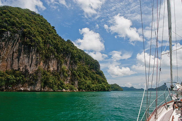
Getting from the southeast Asian tropics to the South African temperate coast requires timing the transitions between northern and southern hemisphere typhoon seasons, navigational challenges within countries that are not always “yacht sensitive,” and long ocean passages with few opportunities for provision stops along the way. Our route took us from Pulau Langkawi, on the Thailand/Malaysia border, down the Malacca Strait to Johor Bahru at the southern tip of the Malay Peninsula, into Indonesia along the eastern coast of Sumatra to the Sunda Strait, across to Cocos (Keeling) Islands, Rodrigues, Mauritius, and finally Richards Bay, South Africa. The journey covered 6,116 nautical miles.

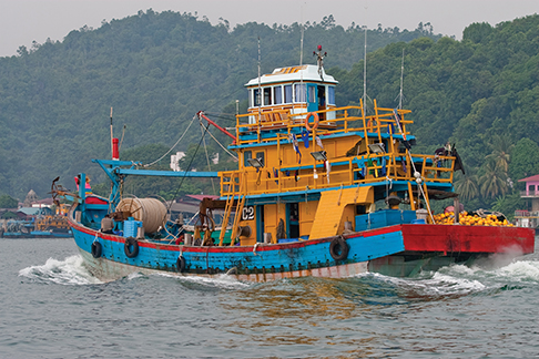
The Malacca Strait is well-charted and a very busy stretch of water. Aside from the thousands of super-sized cargo ships that occupy the shipping lanes, cruisers must also contend with slower tug/tow traffic along the fringes of the traffic lanes (going both directions on either side), as well as a dense concentration of fishing boats (and nets) nearer to shore. The weather is fickle as the steamy heat comes off the island of Sumatra, bringing intense thunderstorms and squalls that wreck havoc with the strong currents. There are few places to anchor between Pulau Penang and Johor Bahru (or Singapore, if you choose) and the trip is often described as “tedious,” as yachts generally have to motor most of the distance. We were amazed that the local forecasts were so consistently wrong during our southbound voyage, with the winds generally coming from the opposite direction and in greater strength than predicted. Rather than being able to sail directly from Langkawi to Johor Bahur, the contrary weather forced us to make several unplanned stops along the way. This actually ended up being a good thing, as we got a chance to visit Lamut, Port Klang, Port Dickson and Malacca, all on the Malay Peninsula. The Danga Bay Marina, in Johor Bahru, is less expensive than marinas in Singapore and we found it a good place to stay while provisioning and preparing Horizon for the upcoming voyage to South Africa.
HELL RIDE/JOY RIDE
Crossing the Malacca Strait after leaving Johor Bahru, heading south, was a considerable challenge as we had to find a gap between the massive cargo ships which were occasionally three-abreast, all traveling between 18 and 20 knots, but we had a nice space in the center in which to wait for a gap in the southbound traffic. Rather than deal with the bureaucratic issues associated with cruising in Indonesian waters, we took advantage of the “safe passage” provision, which permits mariners to transit without stopping. The roughly 600-mile voyage between Johor Bahru/Singapore and the Sunda Strait runs along the east coast of the island of Sumatra divided by three straits; Selat (strait) Durian, Selat Berhala and Selat Bangka, as well as a stretch in the Java Sea. The shipping traffic was heaviest at the entrance to Selat Durian (inside the Riau Island group) but for the most part, the commercial ships were properly lit. AIS cannot be relied on in this area as few of these boats are equipped, and radar does not detect many of the small fishing boats. Despite a forecast to the contrary, we encountered short, steep chop with a 10 to 15 knot wind on the nose during much of our time in this area; it was uncomfortable but not impossible.

Selat Berhala lies within the Inter-tropical Convergence Zone (ITCZ) and massive thunderstorms brewed in all quadrants, particularly over Sumatra. We briefly encountered gusty winds as a squall passed nearby, but then enjoyed a pleasant 60-mile sail in the open waters before reaching Selat Bangka.
We encountered 20+ knot headwinds with steep and confused seas at the entrance to Selat Bangka, and the headwinds persisted throughout the entire distance of the strait. The entrance was jammed with large and small fishing vessels, many dragging lines or nets (often poorly marked), as well as tug/tow boats and ferries. There were nearly 100 small fishing boats concentrated at the shallow exit of Selat Bangka, the majority of which did not use navigation lights until we got quite close.
Once we got out of the shallows of Selat Bangka and into the deeper water of the Java Sea, the fishing boats thinned out and the breeze filled in, and we had a lovely sail in E/SE wind. The numerous oil platforms are essentially where they appear on the chart and are well-lit and easily visible. Not so the scores of fishing boats that haunt the shallows along the southern Sumatra coast, often in vessels carrying only a portable flashlight that is switched on when a boat approaches and collision is eminent. They often use nets with minimal floats, which are very difficult to see whether in daylight or darkness, and we very nearly got tangled in such a net just as we thought we were out of danger. We kept our spotlight busy in this area.
Sunda Strait is very wide but has dangerous rocks in the middle of the channel (5’54S / 105’48E), which were uncovered and breaking when we passed. It is very busy with cargo ship and fast-ferry traffic, but nothing as intense as what we dealt with in the Malacca/Singapore straits! After spending several months enduring fierce tropical days and steamy nights, sailing out of the Sunda Strait into the Trade Winds felt like a weight lifted off our shoulders. We were thrilled to be out of the silt-laden, slow moving shallow waters of Malaysia/Indonesia and back in blue water. Horizon kicked up her heels in the fresh trades to Cocos (Keeling). The Australian Customs/Immigration procedures are relatively easy to accomplish online and our clearance upon arrival was straightforward.
WELCOME DIVERSIONS
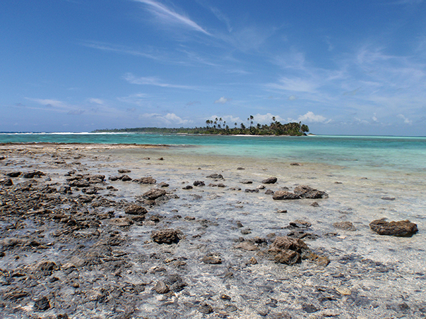
Cocos (Keeling) is a lovely atoll and it’s easy to get comfortable, especially when the passage across the Indian Ocean looms ahead. We read numerous accounts of other sailors’ experiences, and they all included the words “southerly swell.” Our experience was no different. Yachts that departed within weeks of us all encountered the same conditions in varying degrees. Several days of falling off 10-foot peaks in boisterous conditions quickly lost its considerable charm, so we were glad we planned to stop in Rodrigues to break up the passage.

Rodrigues is the smallest of the Mascarene Islands and is located 400 nm east of Mauritius. It has a decent, if often windy, anchorage, but what it lacks in services to cruisers it more than makes up for in warm hospitality and fresh produce.
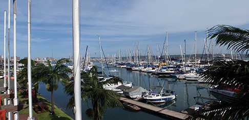
The stretch between Rodrigues and Mauritius can sometimes get significant wind, although in our case the conditions were comfortable. We did experience a huge southerly swell but there was a long period between the 12-foot+ seas that lifted Horizon every 15 seconds or so, only to gently lower her into the troughs. The wind often accelerates around the northern coast of Mauritius and closes out the anchorages tucked in the small islands. These winds gave us a fast trip into Port Louis and the Caudan Marina, the only “walk-on” marina in Mauritius.

Due to the increased number of cruisers taking this route, every foot of the wharf was taken and yachts were often rafted two or three-deep during peak times. Many cruisers opted to stay in Port Louis long enough to stock up on provisions (particularly fresh produce from the exceptional market nearby) and then head either north to Grand Baie or south to the Riviere Noir (Black River) anchorages to escape the crowds.
DANGER ZONE
We embarked on the final leg of the Indian Ocean crossing from Mauritius, although many prefer to visit La Reunion first, to sail around the south coast of Madagascar. Again, the scourge of piracy required us to change our initial route as the islands near the north coast of Madagascar are apparently becoming a haven for pirates and insurance carriers are no longer covering yachts in the northern Mozambique Channel. This passage involves leaving the tropics for the temperate climate as well as dealing with converging currents and sea mounts.
Conventional wisdom suggests sailors allow at least 100 nm (150 is “better”) between themselves and the south coast of Madagascar in order to avoid much of the currents, as well as allow for ample seaway should an inevitable front pass while you are in the area. We were more than 120 nm from Madagascar and still encountered undulating seas that were quite uncomfortable, despite favorable weather conditions. Shipping traffic is also fairly busy in this area and we had several unusual encounters where cargo ships seemed to alter course in order to come close enough visually inspect us. This was disconcerting, particularly at night.
Another aspect of the heavy shipping traffic is the possibility of submerged containers, as the crew of Wizard of Africa sadly learned when she struck a container in the pre-dawn hours. We helped cast her docklines only weeks before when she left Mauritius and our hearts go out to Gerrie and his crew. They spent several hours in a life raft before being rescued by a cargo ship bound for Singapore. This area is also fraught with intense thunderstorms featuring tentacles of lightning which spreads from horizon to horizon. These cells brewed quickly and often brought sudden gusts of strong wind.

A WARM WELCOME
Horizon traveled 6,116 nm between Pulau Langkawi in Malaysia and Richards Bay, S.A. The distance took us 55 days at sea between June 28 and November 16, 2011, from 6’21 degrees north to 28’47 degrees south. As we approached Richards Bay, we slowed down to wait for a frontal system to pass before we approached the Agulhas Current. However, the exact boundaries of the Agulhas shift several miles in either direction and we still managed to get a taste of the steep waves that can build up when an opposing wind meets the swift south-setting current. We had enough room and elected to run with the waves, which added a few miles to our passage but gave us a lovely sail back down the coast to Richards Bay once the front had passed.
Many cruisers choose to make landfall at Richards Bay over Durban because it is a shorter distance from the Mascarenes, but both are prepared to greet incoming yachts. Yachts are instructed to stop at the Tuzi Gazi Small Boat Harbour in Richards Bay for clearance formalities, but it is not uncommon for cruisers in Richards Bay to wait two or three days for Customs and Immigration officials to visit their yachts. In either case, you must contact Port Control prior to entering the harbors to request clearance as both entrances are narrow and the officials give preference to commercial vessels. While Durban offers more in the way of a “big city” environment, Richards Bay is a good choice if you are interested in visiting many of the incredible game parks in the KwaZulu Natal province before you make your way southward towards Cape Town.
According to the Maritime Security Center Horn of Africa piracy report (10/2012) piracy continues to dominate the northern Indian Ocean from Suez and the Strait of Hormuz to 10’S and 78’ E. Yachts are strongly advised to avoid the area, whether individually or within a convoy. Our circumnavigation plans always included a trip to South Africa. While we initially planned to sail along the west coast of Sumatra towards Cocos (Keeling), we timed our seasonal transit properly and our inside passage was fairly “strait-forward.”
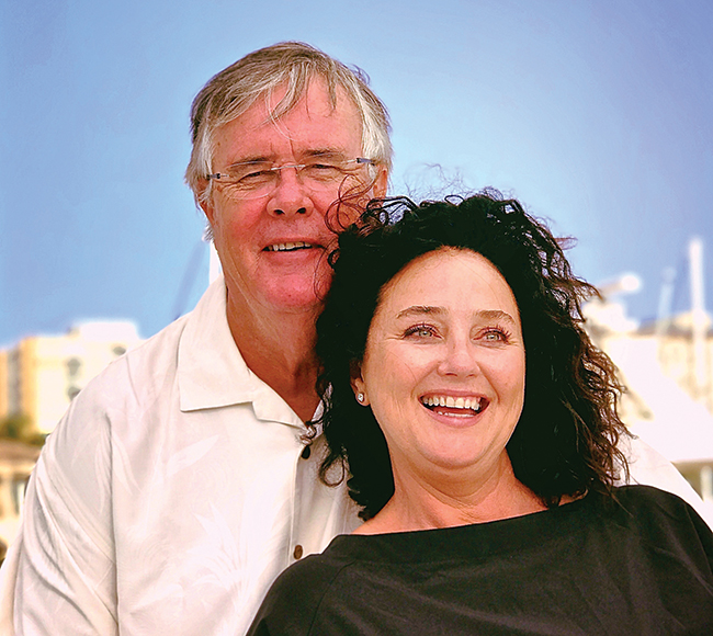
Over the last 10 years, Marci and Joseph Paravia have covered more than 40,000 nautical miles throughout the Pacific between Glacier Bay, Alaska, Tauranga, New Zealand, westward to the Philippines and into SE Asia aboard Horizon, their 38-foot Hans Christian cutter.