


17°29″N 62°59″W (published April 2015)
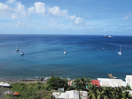
When we reached the summit of St. Eustatius’ iconic volcano, the Quill, the small town of Oranjestad and its adjacent anchorage seemed to be dwarfed by the openness of the blue ocean behind it.
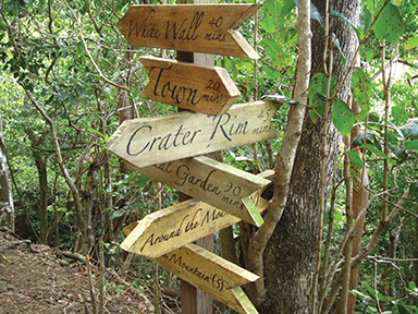
We’d woken in the dark and taken the dinghy ashore to a spot where we could quickly get up the steep bluff that fronts the anchorage. From there it was a quick walk through town to the trailhead for the various hiking trails at the Quill National Park, and as the sun rose, we climbed ever higher through the verdant forest.
Like many cruisers, hiking is one of the things we love to do when visiting new places, so when we found out there was a path leading to the top of the volcano, we had to give it a try. The Quill’s well-marked Rim Trail ranges in its intensity and is a must for sailors visiting tiny Statia. And if you don’t want to go all the way to the top, there are several other trails to choose from that have beautiful viewpoints.
St. Eustatius, or Statia as it is affectionately know, is a small, off-the-well-beaten-charter-path to the south of St. Martin and St. Barth. The island has a population of about 1,000 welcoming inhabitants and its only viable anchorage is Oranjestad Bay, located just below the ramparts of 17th-century Fort Oranje.
Because of the steep cliff at the waterfront, the town is split into two distinct upper and lower sections with trails and a cobblestone road connecting them. There are a few grocery stores, shops and restaurants up in the main part of town, but you’re likely to spend more time snorkeling or hiking than perusing them.
St. Eustatius is also a great stopping point if you have the more popular islands of St. Kitts and Nevis on your itinerary, as they are just a short reach farther south.