


Kiwi Roa last appeared in these pages several years ago, writing out of the sub-Antarctic. Now she has migrated from the deep South, crossing from the Falkland Islands to Cape Town in search of warmer waters (published November 2016)
This 3,330 nautical mile passage, hurled by the westerlies in the Furious Fifties to a new continent, transitioned Kiwi Roa‘s story from a chronicle of ice and rock into a small respite of sand and sun.

Vessels arriving in the Western Cape province must complete formalities in Cape Town, South Africa before moving to a more pleasant harbor. Although not projecting as south as the world’s other great southern tips, the Cape of Good Hope has a reputation from the Agulhas Current and the compact and intense lows that form around it, compounded by rocks and banks extending out. This puts a lot of added stress on vessels that have already rounded the Cape once to check in, as they must double back again if they want to spend time in places such as Simon’s Town.

Kiwi Roa had been damaged en route, suffering a 180 degree knockdown in the southern Atlantic. This little accident would require a full article to elaborate on, but the rig stayed up and all was watertight at the time. Impact damage from loose items falling on the saloon headliner, extensive deck gear damage, and the skipper’s broken ribs lingered as reminders. We thus needed decent facilities for repair, and found them at the Royal Cape Yacht Club, which—although set in a slightly dirty industrial area that includes foreign Asian fishing boats under repair—provided us with an ideal dock in the middle of Cape Town’s marine industry for our eight month stay.
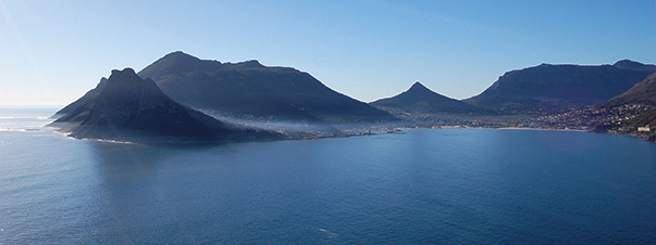
The old Cape Province is full of scenery, prehistoric landscapes, nature reserves—and wine trails. Table Mountain is required hiking, overrun with rock hyraxes—the world’s cutest mammal—all with a high view of the surrounding coastline, valleys, and towns. On the Atlantic side, the Twelve Apostles march southward through the Cape Peninsula, where two lighthouses mark Africa’s south-western end. Many ships were lost on the Cape’s dangers due in part to the original lighthouse being positioned too high and consequently often being obscured completely in the area’s cloud and mist. It was replaced in 1919, set lower down and built precariously on the razorback ridge.

Our long term plans included a foray to the High Latitudes in the Northern Hemisphere, and visiting some of the more interesting southern African coast would shave some miles off the long passage. Dassen Island is a nature reserve found through 30 miles of fog north of Cape Town, fog which lifted after finding the anchorage to reveal countless thousands of birds. House Bay and St Helena Bay hosts dozens of seabird species and, as landing is prohibited, we spent several days onboard and rowing the dinghy around the bays simply taking in the spectacles.

Farther north still, a line on a map is crossed, where Namibia has the next tenable harbor on the inhospitable and aptly named Skeleton Coast. Lüderitz is a well preserved old German colonial town that was birthed in the old diamond industry, along with its dessert satellite of Kolmanskop which is now accessible as a ghostly open museum. This early 1900’s era township is 30 kilometers inland from Lüderitz, slowly losing its battle with the encroaching sands. In its time it was mostly self-sufficient on the wealth of its miners, with even an ice-making plant from which each house would be allocated blocks based on occupancy. Hidden away from the parched windblown dunes and unforgiving sun, a photography studio has a lush tropical backdrop painted on a wall—an enticing backdrop scene for portraits to be sent back to lure unwitting wives or girlfriends to assist colonial settlement efforts. Based here, young men hunted their fortune, trekking into the desert prospecting for themselves or working the company ‘stakes’.
Still today, the powerful diamond corporations own thousands of square miles of Namib Desert and coastline that is heavily protected. Diamonds, along with zinc, are still found on the seafloor close to the coast. As well as large commercial suction dredge ships, local fishing boats have been converted into dredgers using divers to manually direct the suction hose. All vessels are licensed, and product recovered is heavily controlled. There is a local zinc production operation, and ships transport the ingots and diamond bearing gravel for processing elsewhere. This, along with a small specialist lobster industry supplying very young and small wild crayfish to Japan, keeps Lüderitz surviving in the 21st century.

Lüderitz Harbor is well sheltered for the prevailing southerlies, but little room is available close to shore for anchoring amongst local moorings and the restricted maneuvering area for the commercial wharf. Local moorings are not to be relied upon and we preferred sitting further out on our reliable Rocna, which in weather from the west to the north makes the anchorage uncomfortable but not untenable. Better shelter with good holding plus peace and quiet is found at the northern end of Lüderitz Bay, another wildlife viewing spot. Gemsbok antelope, springbok, and pink flamingos were all in sight of the cockpit and a zoom lens.
Kiwi Roa hopped further up the coast. Hottentot Bay is protected from the north but now unused, an abandoned refuge in the midst of the great dunes of the Namib. A fleet of fishing boats from Lüderitz comes for the work week to prey on the shore side reefs, trapping juvenile crayfish for the Japanese market. One boat appeared at our stern with the offer of a dozen crays, its crew hoping for some return trade that would add to their own diet… or, preferably, a bottle of wine.
WALVIS BAY
Walvis Bay, some 250 miles north of Lüderitz and inside the Tropic of Capricorn, is the largest coastal town in Namibia. The bay itself is some 36 square miles enclosed by a large low-lying north-south running sand spit, with room for ships to anchor off in protected waters until a berth is made available. At the time of writing, there is no marina, only a friendly yacht club, and we anchored on good holding in around four meters depth. There is some surge in the anchorage, and if the wind switches to WNW the fetch is long, so a totally reliable anchor and good spring rode is advisable, especially if leaving the vessel unattended for long. We traveled inland to the Namib-Naukluft National Park, and it was only the boat being anchored on a Rocna that gave me the confidence to leave her for half a week.

The Bay surrounds large saltings and mud flats, breeding grounds for millions of water birds from dozens of species. The horizon glows fluorescent in the afternoon sun from the thousands of pink flamingos feeding the shallows. This abundant bird and sea life coupled with the wetlands pump a huge amount of natural fertilizer back into the bay waters, which promotes a soup of algae and nutrients to complete and support the cycle. At optimum water temperature, algae blooms are conjured into being, releasing sulfuric gas into the air. Local letter boxes and street signs are made of plastic as steel does not last long in the acidic environment. The local economy benefits greatly from the tourists and ornithologists who are drawn to this nature reserve. The sand spit itself also attracts wildlife from the sea, and its Point is the favorite attraction for local tour boats, with their tame pelicans in tow, on bird, whale, dolphin, and seal watching trips.
 A large salt producing operation is planted alongside this whirling mass of nature, and contributes somewhat to the mix. Water pumps from the Bay into large canals and ditches, supplying water to the salt pans: sights of bright color in varying stages of evaporation. There is always a healthy swarm of birds from large pelicans to dainty terns feeding on the fish exiting the race of the pumping canal.
 Sossusvlei is a salt and clay pan surrounded by high red dunes, two days driving away in the Naukluft National Park. We voyaged across the desert by the Kuiseb Canyon and River and the Naukluft Mountains, past herds of zebra, gemsbok, oryx, springbok, ostrich, social weavers which turn entire camelthorn trees into their oversized nests, finally to Sesriem, the gate to Sossusvlei and the start of the dunes. A further two hour trip through the old river valley brought the dunes over the horizon, more and more magnificent in their fluctuating colors as sunlight played across their undulations. Beyond these sand mountains, the river was blocked 700 years ago by the unstoppable dunes, killing and parching the land into the Deadvlei (“dead marsh”), now a white clay pan populated by skeletons of ancient camelthorn trees blackened by the sun.
Our flirtation with Africa only touched a tiny part of its expanse, but maybe it was the most enticing part. There could not have been a greater contrast for our break from the cold of the South. Another trans-Atlantic passage lay ahead, sailing out north-west toward the central Atlantic islands and the equator, then eventually back to ice of a northern variety—stories for another time.
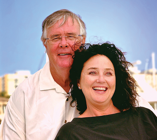
Peter Smith is a New Zealand boat builder, long distance cruiser and offshore sailor, and designer of the Rocna anchor. Peter’s recent voyaging includes the Southern Ocean from New Zealand to Chile, where he spent five years exploring Patagonia and Tierra del Fuego, Antarctica, and the South Atlantic islands of the Falklands and South Georgia, before crossing the Atlantic to Africa. He has now moved into the Northern Hemisphere from where more stories will follow. Read more about Peter and Kiwi Roa’s voyaging, including lots more photos from South Georgia, at www.petersmith.net.nz