


Push a button and know where you are, where you’re going and why? It’s not quite that simple! (published November 2014)
A few years year ago while making a 2:00 a.m. approach to the cut between a couple of British Virgin Island’s unlit isles, I had thought that the approach would be uneventful given modern satellite positioning systems. Soon thereafter, I realized just how wrong I was.
In the final stages of a delivery from New England to the eastern Caribbean, we would be able to get a bearing from lights on Anegada. Even in the dark, we expected GPS, radar, our depth sounder and the high-powered spotlight to get us through a couple of low-lying islands separated by only a mile and a half.
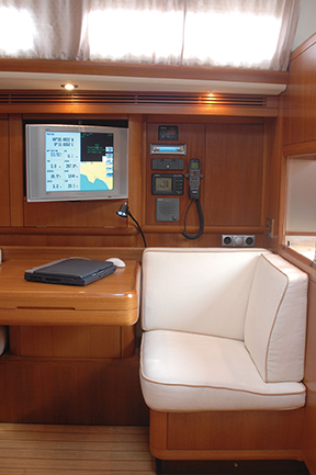
To be on the safe side, it was decided that one of our crew, a qualified delivery skipper in his own right, would maintain a “conventional” DR plot using lights, depth and radar fixes manually plotted on a paper chart of the islands. Meanwhile, I would use the digital charts on my laptop with our position proudly displayed on the screen; thanks to our trusty GPS and the charting software on the computer. The little yellow boat icon slowly got closer to the islands.
Prudent navigation requires not only a fix, but a confirmation of that fix, and preferably an additional confirmation beyond that. Technology doesn’t absolve us of those requirements. A mile and a half from the narrow passage between the islands, our “trusty” GPS decided to go on holiday. “No GPS Signal” was now proudly displayed on the computer screen, and no time was provided for the last GPS fix. The charting software froze the icon in place on the computer screen as we plunged headlong into the darkness.
A quick check of the GPS unit itself confirmed the obvious: No Position. It was 2:00 a.m. There was no moon, and the sky was cloud covered. Fortunately, a conservative approach to safety issues and decades of redundancy in the nav station paid off in the middle of that one night. The crew was on the job and had we been in the middle of the channel, we could have continued on our DR to get through.
When a GPS shuts down, if you’re not keeping a written log or penciling a DR plot with time indicated, you don’t know how far off your last known position you may actually be. Was the boat in that spot on the computer screen five minutes ago or 20 minutes ago? Have you been doing five knots or 7.5? The difference could decide whether you tie the boat up in the morning or swim to the beach tonight. I silently blessed all of the people who had helped me to learn bits and pieces of navigation and who had refused to allow me to get away with only taking one fix without a confirmation.
We were still a mile and a half from the slot between the islands and we had plenty of water on three sides. It was decided to take the main down, spin the boat around onto a reciprocal course and get to the bottom of the GPS problem before continuing on our way. This was no time to let an unknown current take us off our DR course and onto the bricks. Within 15 minutes the GPS decided to return from its “holiday” and our backup handheld unit confirmed our position. We again spun the boat around and motored through the channel.
Nine months later, my merely cautious faith in the GPS would be again confirmed, this time back in New England on a different boat. While finishing the Vineyard Race, we crossed the line at Stamford, Connecticut’s breakwater. We were under spinnaker and would need to bear away, out of the channel and toward very shallow water. It would be necessary to drop the chute and head up to get back in the channel in a few minutes before we ran out of water. I had been moving between the deck and the nav station, taking times, checking water depths and monitoring the radio as I noticed on the laptop that we were coming dangerously close to shallow water. I called to the helmsman to make sure he was headed back into the channel. He was, and I confirmed the action and position on deck. We were in safe water, but back down below things appeared quite differently on the computer.
The GPS—a very reliable, permanently mounted unit—had dropped the signal at a critical moment. The charting software kept running a DR plot based on our earlier speed and heading rather than “freezing” the icon as the previous software had nine months earlier in the previous situation. The icon resolutely sailed on, crossing through a couple of feet of water, over the beach and into downtown Stamford—quite a feat that I was glad we weren’t trying to duplicate in reality!
GPS revealed its dark side to me a third time as we raced at a record pace in the Middle Sea Race. We had been experiencing electrical problems aboard the boat that caused the sailing instruments to short out. The usually reliable GPS was still functioning well, but with the instruments shut off, the instrument bus was no longer capable of carrying the signal to the computer. I hooked up my battery operated Garmin, taped the remote antenna to the hatch, and plugged the unit’s NMEA 0183 cable into the back of my laptop. We were good to go with two completely independent units. That is, we were “good to go” until they both shut down simultaneously.
As we passed Stromboli’s active volcano north of Sicily, both units temporarily ceased operation. Within a half an hour both GPSs were back in operation after automatically re-acquiring the satellite signals. Perhaps it was electrical or magnetic interference from the volcano this time. I can’t really say. But what I do know is this: navigators need to have a backup plan for their GPS units. Parallel rulers, dividers, hand-bearing compasses, paper charts and pencils can still go a long way in getting you through an otherwise very tough situation. It is also important to understand that an accurate depth sounder can at least provide you with one possible line of position (LOP), but that line can be vague if the water depth is only gradually changing.
We need to know how our charting software handles a lost signal and how that signal is indicated on the computer’s screen. Will the icon freeze in place or will an automatic DR take over re-positioning the boat’s icon? Will a big, bright red notice or a more discreet small, gray note indicate the lost signal? Regardless of the tools we use, the navigator is still well advised to confirm his position using several different methods. Those time-honored techniques still apply, even with today’s often-spectacular technology. Three separate GPS failures on different boats, using different GPS units and different computer software in widely separated parts of the world has convinced me of that.
Bill Biewenga is a navigator, delivery skipper and weather router. His websites are www.weather4sailors.com and www.WxAdvantage.com. He can be contacted at billbiewenga@cox.net